Xiang Khuang Province
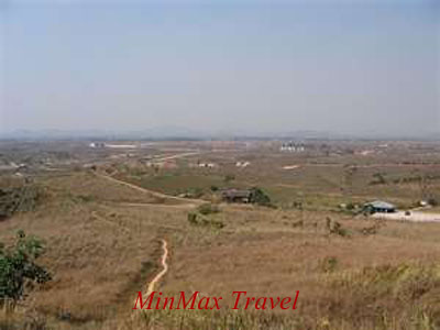
Xieng Khuang Province is marked by contrasts, cultural and geographical. In the centre, broad ochre hills, laid bare from logging and slash and burn agriculture, coat the semiflat terrain. Orderly farms intersperse the brown hues, and the eucalypts and pine plantations invoke antipodeans impressions. As the province stretches north it finds the base of Hua Phan’s mountainous ascent. 
Flying in from the south, one is struck by the beauty of high green mountains, rugged karst formations and verdant valleys. But as the plane begins to descend, you notice how much of the province is pockmarked with bomb craters in which little or no vegetation grows. Xieng Khuang was one of the most devastated provinces of the war. Virtually every town and village in the province was bombed at some point between 1964 and 1973.
The province has a total population of around 230, 000 people, mostly comprised of lowland Lao, Vietnamese, Thai Dam, Hmong and Phuan. The original capital, Xieng Khuang, was almost totally bombed out, so the capital was moved to Phonsavan (often spelt Phonsavanh) after the 1975 change of government. Near Phonsavan is the mysterious Thong Hai Hin (Plain of Jars).
The altitude (average 1200m) in central Xieng Khuang creates an excellent climate –not too hot in the hot season, not too cold in the cool season and not too wet in the rainy season. The coldest months are December and January, when visitors should come with sweaters or pullovers, plus a light jacket for nights and early mornings.

