- Vietnam Overview
- Main Cities in Vietnam
- Regions in Vietnam
- Other Cities in Vietnam
- Getting to Vietnam
- Getting Around Vietnam
- Language in Vietnam
- Education in Vietnam
- Vietnam Activities
- Vietnam Attractions
- Vietnam Money & Shopping
- Eating and Drinking in Vietnam
- Dress Code in Vietnam
- Gift Giving in Vietnam
- Public Behavior in Vietnam
- Art Performance
- Custom and Habits
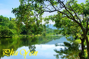
Phu Yen Province
Phu Yen has a quite diversified resources of land, forest, sea, rivers, lagoons, bays such as Cu Mong, Xuan Dai bays, O Loan, Vung Ro lagoons, Ba, Ky Lo, and Ban Thach rivers. Phu Yen owns Da Rang Bridge, the longest one in Central Vietnam
Geography
Situated in South-Central Coast, Phu Yen shares border with Binh Dinh Province on the north, Khanh Hoa Province on the south, Dak Lak and Gia Lai provinces on the west and East Sea on the east.
The terrain is divided into two main area including mountain, hill, plain and more than 100km seaside.
Phu Yen has a quite diversified resources of land, forest, sea, rivers, lagoons, bays such as Cu Mong, Xuan Dai bays, O Loan, Vung Ro lagoons, Ba, Ky Lo, and Ban Thach rivers. Phu Yen owns Da Rang Bridge, the longest one in Central Vietnam
Phu Yen is divided into 1 city, 1 town and 7 districts:
- Tuy Hòa City (municipality)
- Đồng Xuân
- Sông Cầu Town
- Tuy An
- Sơn Hòa
- Phú Hòa
- Tây Hòa
- Đông Hòa
- Sông Hinh
Climate: Influenced by ocean climate, the weather here is hot with high humid and lots of rain. Annual average temperature is 26.5ºC.
Tourism
Phu Yen has beautiful landscapes following: Nhan Tower on the northern bank of the Da Rang River. This was a place of worship for the Cham people dated in the late 11th to the early 12th centuries.
On the north, visitors are able to swim in My A Beach (Long Thuy), an incredibly beautiful beach with white sand and clear water under the shadows of coconut trees, or discover O Loan lagoon, Hon Chua, Hon Yen islands, Tien Beach, Da Trang Pagoda, and discover Da Dia Rapids with special 35,000 stone columns. On the south, there are Vung Ro Port, Ro Bay and Bac Deo Ca Natural Preservation that has rich of flora and fauna. The west of Phu Yen is Krong Trai National Preservation and Go Thi Thung Vestige. The most famous seafood dish form in this area is grilled blood clam.

