- Vietnam Overview
- Main Cities in Vietnam
- Regions in Vietnam
- Other Cities in Vietnam
- Getting to Vietnam
- Getting Around Vietnam
- Language in Vietnam
- Education in Vietnam
- Vietnam Activities
- Vietnam Attractions
- Vietnam Money & Shopping
- Eating and Drinking in Vietnam
- Dress Code in Vietnam
- Gift Giving in Vietnam
- Public Behavior in Vietnam
- Art Performance
- Custom and Habits
Thai Binh Province
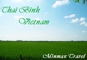
Belongs to the Red River Delta, Thai Binh is a granary of North Vietnam. The province is surrounded by Hai Duong Province and Hai Phong City on the north, Ha Nam and Hung Yen provinces on the west, East Sea on the east and Nam Dinh Province on the south.
 Three faces of Thai Binh are Red, Luoc and Hoa rivers, and one face is 53km seaside and no any mountain.
The subsequent fertile soil was excellent for growing grains, especially rice. Thai Binh rice is acknowledged as the best strain in the North of Vietnam. There are 200 types of aquaculture and 2,500 kinds of rare birds, too.
Climate: On monsoon tropical region, Thai Binh has cold winter (from November to April) and hot summer (from May to October). Annual average temperature is 23.5ºC, the lowest temperature is 4?C and the highest one is 38ºC. Average rainfall is from 1.400mm to 1.800mm
Due to its richness of aquatic products and grains, locals here have created a number of local specialties from their natural materials; among of these the most famous are Canh Ca Quynh Coi (Quynh Coi fish soup) and cay cake.
Coming to Thai Binh, tourists enjoy visiting inshore sandbanks where rare birds stops, seeing natural beauty in mangrove forest, swimming in Dong Chau Beach, and joining interesting traditional festivals. Well-known culture constructions are Dong Bang, Tien La temples, and Keo Pagoda. There are many valuable votive objects and beautiful three-storey bell tower in Keo Pagoda. Various flowers and fruits in Bach Thuan Garden Village also attract many visitors every year.
This province is rich of traditional handicraft villages like weave fabric in Phuong La, mat weave in Hoi, silver carve in Dong Xam, copper casting in An Long, lace embroider in Minh Lang, cay cake making in Nguyen Xa.
Visitors are able to enjoy many folk songs, festival games in traditional festivals such as water puppet in Nguyen Xa, cheo song in Khuoc, fish and duck catching, rice cooking competition and squib contests.

